A quality model of open-source Sentinel-1 SAR data by temporal and spatial modelling
Large-scale deformation monitoring of civil infrastructures such as buildings, bridges, and railways or natural objects in a long-term, low-cost (or freely available), accurate, and reliable manner is still challenging. In this study, the Persistent Scatterer Interferometry (PSI) technique is applied using open-source synthetic aperture radar (SAR) data from C-band of satellite Sentinel-1. The quality assurance of the Persistent Scatterer (PS) data points is performed prior to deformation monitoring to judge the significance of deformations. Therefore, a general multi step procedure is developed and implemented which enables performing quality check of the PS data points by temporal and spatial modelling.
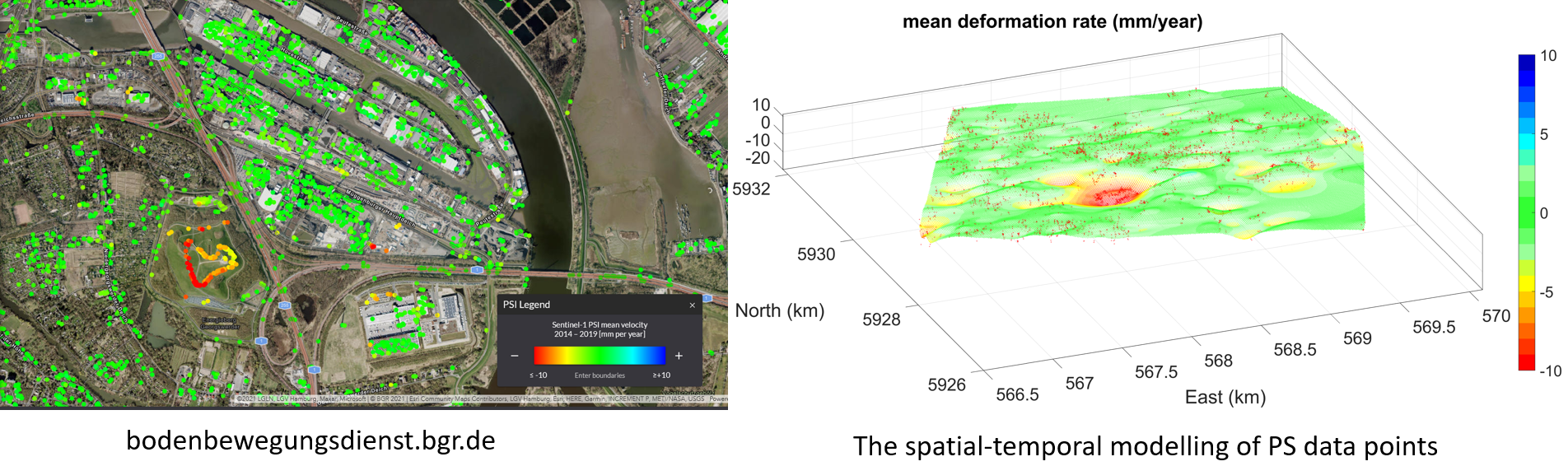
For this purpose, first, the PS data points are classified into buildings and ground types using LoD2 building models. Second, temporal modelling is carried out by time series analysis of the discrete PS points to estimate the offset, the deformation rate, and standard deviation for each PS point time series. Third, spatial modelling is performed based on the Multilevel B-Splines Approximation (MBA) for local geometric patches of the PS points. Having a continues surface enables the user to make predictions at any arbitrary position. Fourth, a data adaptive outlier detection algorithm is applied to identify and reject the outliers. The spatially-based outlier detection is beneficial compared to temporal one due to globally testing the deviations of the PS points to the model. Fifth, a 95% confidence interval is estimated for the approximated surface in the local geometric patches based on a bootstrapping approach. Subsequently, an appropriate quality model of the PS data is obtained by above-mentioned five steps temporal and spatial modellings.
A deformation analysis is carried out for areas of interest in the state of Lower Saxony, Germany. In this study, the PS data points are extracted from freely available online platform of the BodenBewegungsdienst Deutschland (Ground Motion Service Germany) provided by the Federal Institute for Geosciences and Natural Resources (BGR), Germany. For the purpose of validation, a time series of leveling and Global Navigation Satellite System (GNSS) measurements in the area of Hengstlage, Germany, are considered, which provided by Landesamt für Geoinformation und Landesvermessung Niedersachsen (LGLN). In the end, the results of the deformation analysis are compared with the results obtained from the BGR. The outcomes of this study can be used to track earth surface displacements in time. This information could be helpful in understanding natural hazard processes such as landslides, earthquakes, and floods, and to improve the safety and resilience of communities and infrastructure.